49 (First Floor), CSC-3,
DDA Market, Sector-11, Rohini.
Delhi – 110085. India.
GIS Mapping And Data Management Services
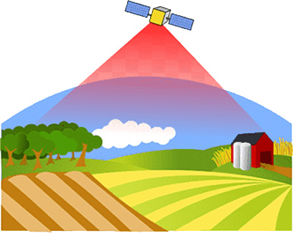
GIS is a spatial system for creating, managing, analyzing, and mapping various types of data. (Geographic Information Systems) GIS mapping and Data management are critical to project success by providing adequate storage, management, and distribution of valuable data.
Our GIS mapping services make it possible to see and comprehend data by locating connections, patterns, and trends. Furthermore, it gives users access to a digital platform for viewing and processing spatial data layers.
- Digitalization and Data Conversion
- ESRI – compliant GIS Database generation
- Remote Sensing and GIS integration
- Geospatial Analysis & Analytics
- Cartographic Services
GIS Geographic Information System Mapping Services
We provide a distinctive foundation of modeling, environmental, and asset management expertise from a variety of industry sectors, allowing us to offer top-notch solutions to the issues faced by our clients. This is backed up by our capacity to transfer knowledge across industries as well as a track record of web and standalone GIS systems for various operational landscapes.
To ensure successful project-specific applications, PJRCS constantly creates cutting-edge tools. We collaborate with clients to meet their specific requirements. In addition to offering users a distinctive visual experience, these tools analyze and relate large, complex data sets.
Data Management -an overview
Our consultants will assist you with feasibility and constraints analysis, site selection, data collection and management, data interpretation and analysis, data conversion, integration and interoperability, and real-time monitoring. We provide a range of products and services to serve our client's specific needs. These may include document management systems, or asset management systems.
Need for Mapping and Geographic Information Systems (GIS)
For clients to receive a comprehensive picture of their operations, our experts work with a wide range of data and seamlessly integrate these into their analysis. This includes information gathered through surveys, monitoring, modeling, and data obtained from outside sources.
We provide the best foundation for mapping and analysis that is used in science and almost every industry. We help users understand patterns, relationships, and geographic context. Better management and decision-making are among the advantages, along with improved communication and efficiency.
Our systems and applications are created using leading industry standard GIS software with specialists who carry a breadth of expertise in capturing and extracting the maximum value from your geospatial data and offering specialized GIS solutions.